|
|||||||||||||||||||||
 |
|
||||||||||||||||||||
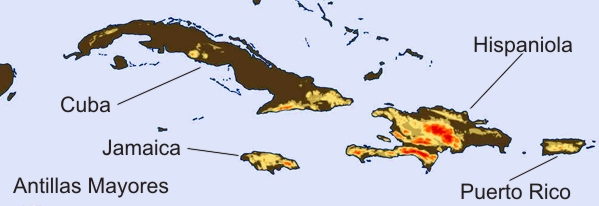
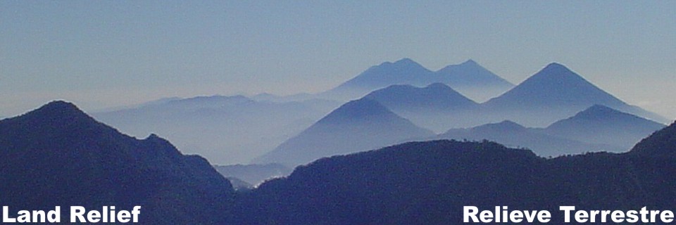
In the Greater Antilles islands relief is high and abrupt with the highest elevations on the Island of Hispaniola with Pico Duarte (10416.7 famsl), Pico la Selle (8773.0 famsl) and Alto de la Bandera (9324.1 famsl). On the island of Jamaica they are Blue Mountain Peak (7401.6 famsl) and some others above 3937.0 feets. The relief of the island of Cuba is up 90% plaine and the unique relief of importance are at the southern end with Sierra Maestra. The relief of Puerto Rico is abrupt and of low altitude.
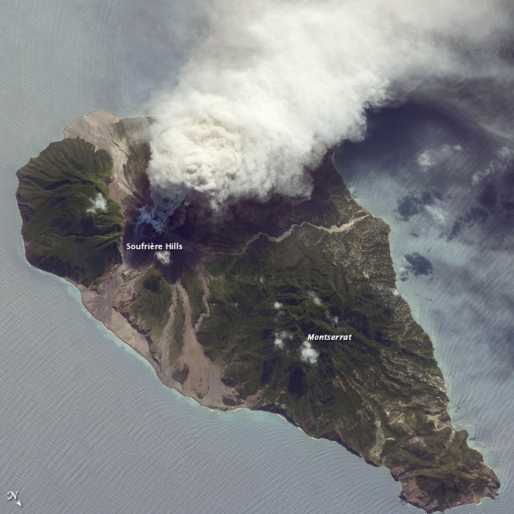
The islands of the Lesser Antilles have a low overall topography like in the smaller islands of Anguilla, Antigua, Barbuda and Barbados. The islands that have a more rugged topography, the mountains are in many cases active volcanoes. Among the most important are Montagne Pelee on the Island of Martinique
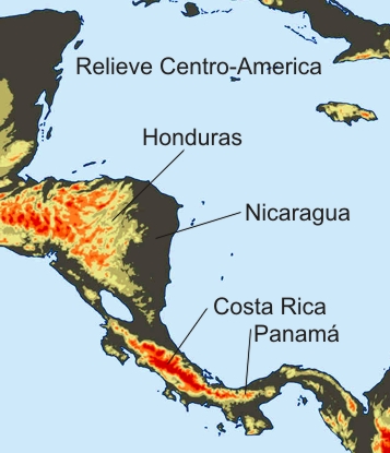
To the west of the Caribbean Sea, in Central America, the coastal relief is flat in general. The mountain formations of Honduras and Colombia are the oldest as well as the lowlands of Nicaragua that extend beneath the waters of the Caribbean Sea between the basins of Yucatan and Colombia. The mountains of Costa Rica and Panama and up to the north are of recent geological origin and is characterized by active volcanoes.
Until a recent geological past, Costa Rica and Panama did not existed, so the American continent was divided by a stretch of water through which the Atlantic and Pacific communicated. With the emergence of land about 2 to 3 million years, apeared the isthmus that joined, with a piece of land, South and North America. The entire chain of volcanoes in Central America along with the movements of the Tectonic plates surrounding the Caribbean Plate are also the responsible for the emergence of this strip of land The Caribbean Sea bounded on the south by northern South America where two branches of the Andes ends. Although seismic activity that presents this area has a certain intensity shows no volcanic activity.
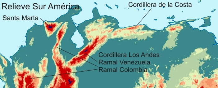
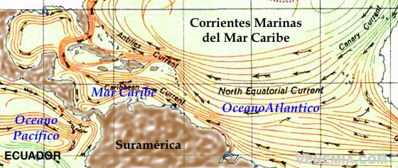
Topographical relief of the Carribbean section of South America with the ends of the Andes Mountains of Colombia and Venezuela and the separated seccion of Santa Marta with heights of 18946.8 feets. OCEAN CURRENTS
The north-equatorial ocean current of the Atlantic Ocean flow near the coast of Brazil and the Guianas and enters the Caribbean Sea in two places, the most souther is through the West Indies between the islands of Trinidad and Granada. The other important entrance to the Caribbean Sea of the Atlantic equatorial current is through the Straits of Anegada The average salinity of the Caribbean Sea is 35 to 36 parts per million; however, the current entering Trinidad is characterized by shallow water with salinity of 35.5 parts per million and 68°F temperature, the more supeficial layers are less salty and with temperatures ranging between 75.2°F and 86°F, condition mainly caused by the incorporation to the ocean of large amounts of freshwater and sediments from the Orinoco and Amazon River. This condition reduces in part the general salinity of the surface water development and induces large concentrations of chlorophyll in the eastern sea. |
| ||||||||||||||||||||